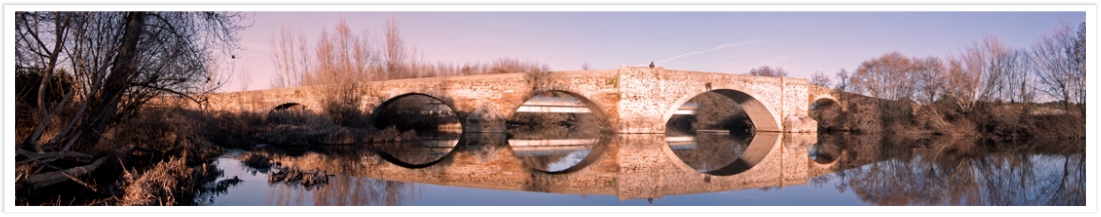
The proposed trail, as it is possible, matches with the original trail of La Vizana, between the region of Babia
(León) and Trujillo (Cáceres). There are two alternative routes in Babia, because the track divides into two
branches in Pandorado (León): the Upper Babia branch and the Lower Babia branch.
The trail is the result of the information provided by the regional governments of Castille and León and
Extremadura, the literature review and the Ordonance Survey maps. Both the whole track of the route and the
single stages can be downloaded in .gpx format and can be used in GPS devices. Otherwise, they can be applied
by email for using in smartphones through Google app My Maps.
Road sections have been avoided. In addition, the track goes through the main urban areas, especially those
which are start or end of stage, in order to promote the cultural and historical heritage linked to this ancient
route.
This website provides information about the trail of the transhumance. In no case may we be responsible of the
poor condition of the paths, which are many times removed by new road infrastructures, or of the diverse
circumstances that can happen during the journey.
 |
 |
 |
 |
 |
 |
 |
 |
 |
Asociación para el Desarrollo Rural La Vizana. 2015. All rights reserved. Legal notice